
Dorchester Illustration no. 2280 Houses at Commercial Point
Soon after 1800 Joseph Newell and Ebenezer Niles, who thought Commercial Point would prosper in whale and cod fishing, built neighboring large, square, palatial houses on the south side of the point looking south toward Port Norfolk. They connected themselves as partners in business, built vessels and were actively engaged in commercial matters, but the panic resulting from the War of 1812 put a close to their business speculations and prospects.
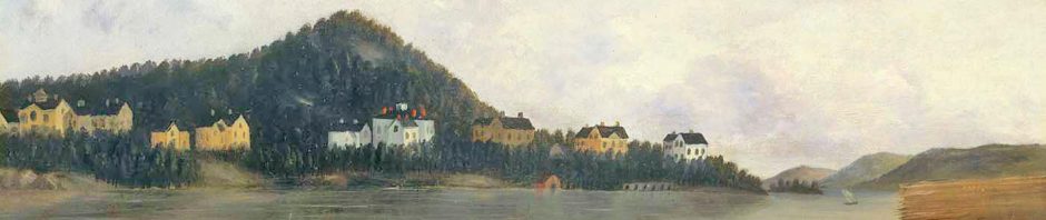
In the painting that is today’s illustration, Newell’s and Niles’ houses are the two white federal-style buildings that look identical.
Commercial Point served many commercial interests throughout the rest of the 19th century including Preston’s chocolate factory and wharf, a syndicate in the late 1820s and 30s for the whale fishing, and the Cutter heating fuel company. Cutter started by selling wood for heating homes and later coal. At the end of the 19th century, Commercial Point became dominated with coal gas holders of the Boston Gas Company, and in the 20th century the Point saw the introduction of metal tanks for natural gas. Today we are left with the one colorful tank that serves as a landmark for traffic reports during the morning and evening commute along the Southeast Expressway.
The streets lost to development of the Point by Boston Gas and through the construction of the highway include: part of Preston Street, Plymouth Street, Washington Street, Pleasant Street, Neponset Street and Union Street.
The channel of water visible in the painting was Tenean Creek and its branch Barque Warwick Cove.
The archive of these historical posts can be viewed on the blog at www.dorchesterhistoricalsocietyblog.org