Dorchester Illustration no. 2459 1896 map
I have always been fascinated by maps. In addition I like exploring how our roads and highways affect our lives – the choices made in the past, about where our roads should go, that force us to travel one way or another.
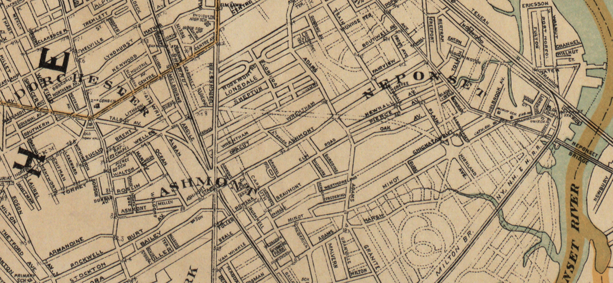
The detail from an 1896 map presented as today’s illustration shows some proposed streets that luckily did not come into being. These roads would have cut through residential neighborhoods, requiring the demolition of many homes.
The proposed road in the center of the illustration runs along an angled line from the intersection of Welles Avenue and Dorchester Avenue to Minot Street where it ends in a big circle where many streets meet. It cuts through Shepton and Edwin Streets, through Monsignor Lydon way (then Templeton Street), to cross Adams Street at Ashmont Street. Then it continues through Newhall, Pierce and Oakton and Chickatawbut.
Another proposed street ending in the same circle on Minot Street connected to Freeport Street, where Ashmont Street ends at Neponset Avenue. This route would have cut through Coffey Street and Chickatawbut.
Map: Boston and Surroundings. (Boston: Published by Geo. H. Walker & Co., 1896) available online at
https://collections.leventhalmap.org/search/commonwealth:wd376710q#